
Public transport network maps
Maps of all the public transport routes by region.

City centre
free bus routes, train stations, tram stops, bus stops and cycle hubs.

12 minutes or less bus and tram map
Map showing daytime buses and trams every 12 minutes or less. Please note: Not all bus stops are shown. Evening and weekend timings can be different.

Cycling maps
Maps of cycle routes and paths across each of the GM boroughs.

Getting to hospital by public transport
Public transport options by hospital with estimated travel time.


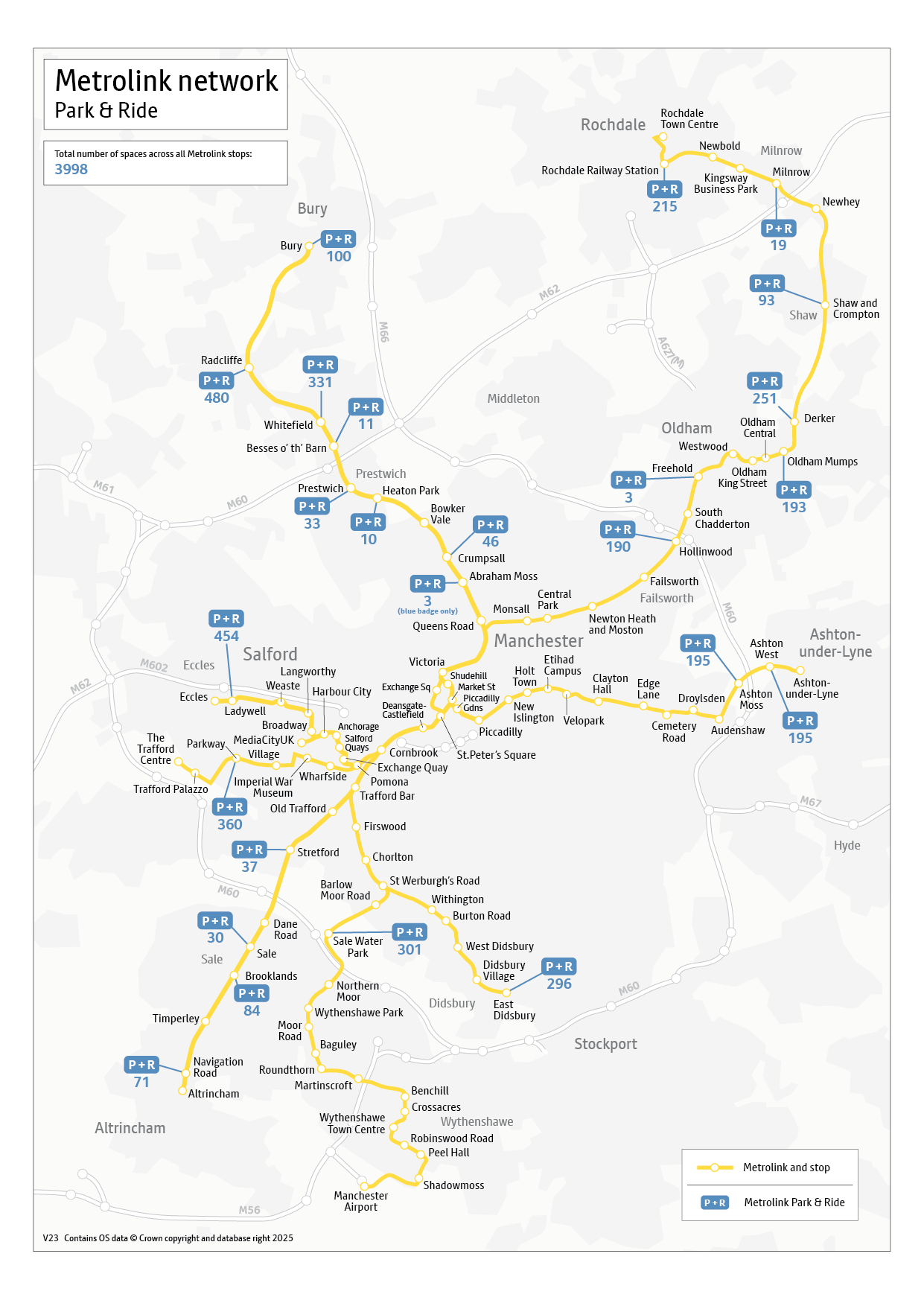
Metrolink geographical map
See the Metrolink network geographically mapped out across Greater Manchester.

Bus route maps
A map of a bus route can be found by searching for the bus route number and clicking on "map view". This will display all the bus stops along the route.

Greater Manchester bus boundary map
A map showing the boundary of Greater Manchester for bus services.


Wayfarer bus map
A map of where you can go via bus if you are using a Wayfarer ticket to travel. For more information about Wayfarer tickets, you can visit our Wayfarer pages.

Wayfarer train and tram map
A map of where you can go via train or tram if you are using a Wayfarer ticket to travel. For more information about Wayfarer tickets, you can visit our Wayfarer pages.